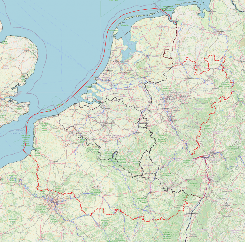
The Rural Riches project focusses on northern Gaul. Northern Gaul in Merovingian times distinguishes itself from central and southern Gaul in several respects. One of them is the general presence of a lavish burial rite resulting in thousands and thousands of graves with abundant grave goods in women’s and men’s graves. Further south lavish burial is present but less common. Another characteristic of Merovingian northern Gaul is the strong decline of Roman towns and the absence of bishops in the fifth century in many of them. The nature of the burial rites and the condition of towns were two important criteria in determining the limits of our research area. The limits are indicated on the map below.
However, we want to take in a flexible position. While collecting data we took on board a series of sites in the German Wetterau, although we do not aim at a comprehensive collection of all sites such as we intend to do for the research area proper.
In defining this research area we think we are able to follow a number of fundamental processes characteristic for northern Gaul in Merovingian times. In the late fifth and early sixth century no one would consider this an important part of the former Roman Empire, and no one would have predicted that it is from this part of the world that western Europe would be dominated 300 years later. Something happened in this region which deserves our curiosity.
A first ‘natural’ choice was to take the Rhine frontier as the northern limit. However, we felt that it was important to compare developments inside the former Roman Empire with those just outside. So, it was decided to include the northern Netherlands and Nordrhein-Westfalen across the Rhine River in Germany. We then decided to follow the Rhine River southwards until Karlsruhe, to include the densely populated area of Rheinhessen. Then we move away from the Rhine River in a westerly direction to cross over to the heights of the Vosges and follow this mountain range to the south so as to include the important road from Strasbourg to the west in the direction of Metz and Reims. From there the limits of our research area extent further west. It is not easy to find a proper southern limit in the densely populated northwestern France. Here practical reasons also played a role. One of the goals we set ourselves was creating a good database on all Merovingian sites in the research area. If this area was too large this task would prove to be impossible to realize, if it was too small we would certainly not be able to observe a number of important developments in the area. We also wanted of course to include a number of towns. So we decided to include a number of civitates at the southern limits of the research area. They are Metz, Verdun, Reims, Soissons, Beauvais and Amiens. We did not want to enter the Paris Basin to the south because that is a region related to developments in central Gaul, which can among others be seen in a much more intensive presence of kings and aristocrats. Moreover it has been intensively studied by the team of the ‘Programme collectif de recherche, Archéologie des nécropoles mérovingiennes en Île-de-France’. They created a database on Merovingian archaeology of their own.