A Simplified Landscape

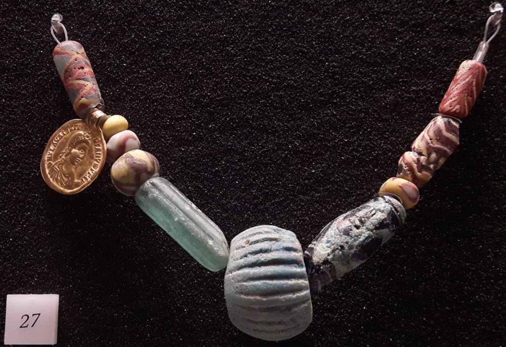
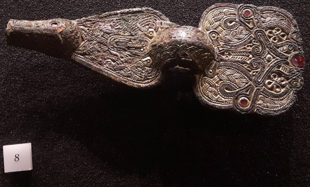
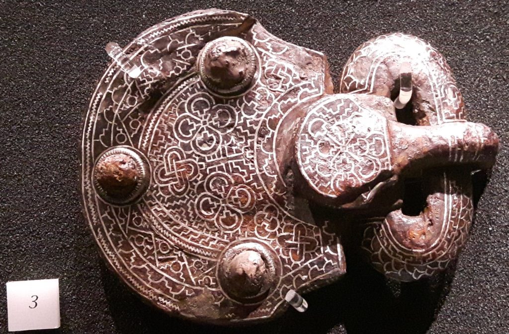
Question: what was the landscape like in Merovingian northern Gaul?

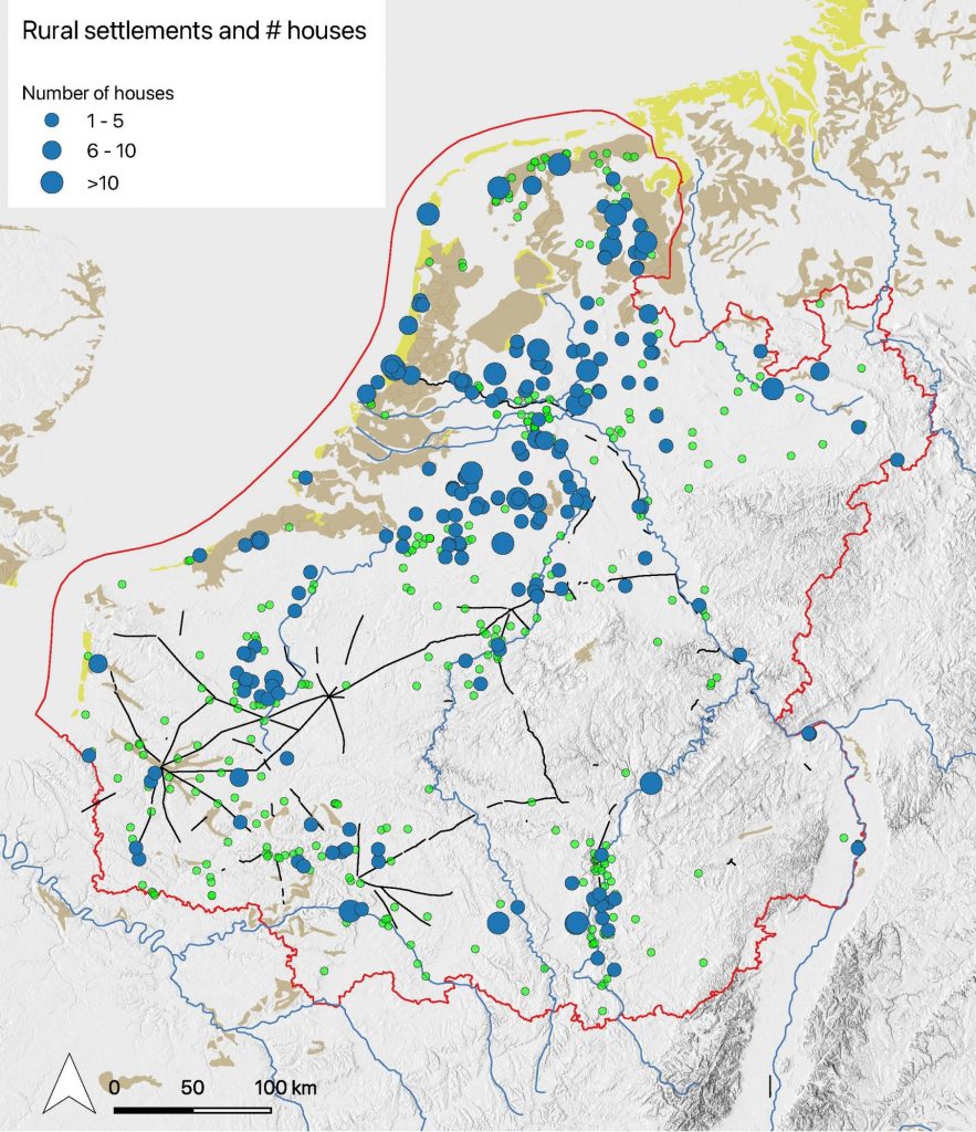
To have an idea of what the landscape was like in the early medieval period, I made the map below a while ago. It shows the main soil and paleo-geographical features of northwestern Europe in the Early Middle Ages. The supposition here being that most of the geology and geomorphology of northwestern Europe have not changed dramatically since the Early Middle Ages. At least, not on a scale that would be visible on a small-scale map like this. The major exception to this rule being, of course, the Netherlands. Fortunately the Atlas of the Holocene is available (downloadable from the Dutch Cultural Heritage Agency) and can be plotted on top of the geological information of the rest of Europe as can be retrieved from the European Soil Database (downloadable from Eurostat).

Paleo-Geographical and Soil map of northwestern Europe (around 800 CE.)

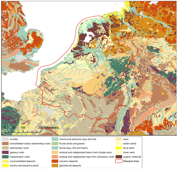
Although this map looks very accurate and complete, a better map can be imagined to help with your archaeological interpretations. Yes, it does show what the soil consists of, but no, it is not a nice map to use as a background to plot your archaeological distributions on; the dots would simply get lost in all the different colors.

The solution would then be to simplify the map-legend. But to simplify the legend into something even more meaningful than just putting everything on display, is to ask a different question: What is it exactly in the landscape that matters? If the answer to that question is ‘geology’, then this is indeed the map for you. But it probably is not geology by itself, but geology as a proxy for ecology.

Knowledge of the geology and ecology in which local communities carved out a living is fundamental to the understanding of their day-to-day activities and social organization. But let me make two points about this very clear before we take this discussion any further. First, the landscape does not determine the way people make their living. Yes, the environment (vis-à-vis the available knowledge and technology) poses outer limits on what can be done in a locality, because of e.g. the amount of rain, average summer temperature, length of the growing season, daily or seasonal flooding, etc. But within these limits social aspects are often more decisive in the choice for livelihood strategies than environmental factors are. Second, at the other end of the spectrum, a precise ethnographic ecology is not attainable to us right now. I would assume that local communities had a knowledge of the ecology and geology far more precise than is visible in the above map. Or in any map we have, since probably a different science was used to classify things, according to different meanings and values.

The above map is thus too precise and not precise enough at the same time. The challenge then is to simplify the landscape in a way that it can function as a frame to interpret the archaeology of early medieval Europe. A simplified landscape is therefore presented in the map below. The main ecological settings are determined on the localities’ relationship with surface water (marine, fluvial and peat), natural agricultural productivity of the soil (not natural climax vegetation) and altitude.

A Simplified Landscape map of northwestern Europe (around 800 CE.)

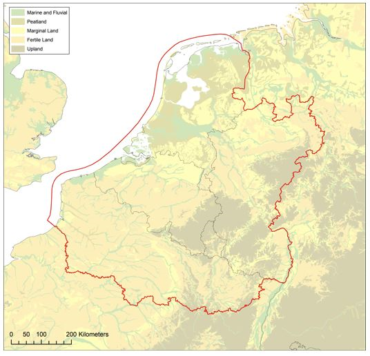
These ecological settings will undoubtedly have had various meanings for local communities, but they most importantly serve as major agronomic conditions for growing crops regardless of the local cultural system. Again, nothing is completely determined by these ecological settings: with determination and technology any landscape can be brought under the plough successfully. So, this map does not serve as a frame to determine who was doing what and where, but it provides an indication of the amount of determination and ingenuity it takes to pursue certain livelihood strategies in certain localities.

The database starts producing interesting results!!

When interesting questions are asked!

After several years of adding data to the database (not full time!) we are writing a large series of queries based on questions formulated by team members. Now gradually the potential of the database becomes visible, especially when combining evidence from various parts of the database. We started, of course by asking very basic questions such as those which allow an assessment of the quality of the database and the quality of the data. A simple question is to show the recorded cemetery sites according to the number of graves excavated/recorded. This results in the map below. In spite of the flaws inherent in the cemetery data (incomplete cemeteries, many ‘unknown’) this allows a first analysis of the distribution of the population over Northern Gaul. We will do this in relation to landscape characteristics, the remaining Roman infrastructure, the presence of rivers etc.

The distribution of cemetery sites according to size.

The quality of the data

The database also allows to analyse the quality of the data. This varies considerably over the research area and we have to consider this constantly when interpreting distribution maps. Merovingian cemeteries have been discovered already from before AD 1800 especially in France and in areas where stone sarcophagi and stone built graves were discovered while reclaiming land or ploughing fields. Cemeteries discovered in the 19th century were usually ‘explored’ rather than ‘excavated’. The goals of the exploration (adding to museum collections or providing the antiques market) will have determined to a large extent what was collected. The map below shows the cemeteries discovered before the First World War. Most of them were subject to exploration and limited documentation.

Cemetery sites discovered before the First World War.

When one compares this image with the one of the distribution of cemeteries discovered only after 1980 that are larger than 100 graves, that is those which have been excavated (and published) in a modern way one can see how limited the availability of high quality data is.

Cemetery sites discovered after 1980 with more than 100 graves.

Rural settlements

The distribution of excavations of rural settlements shows also very interesting regional differences. Many excavations of Merovingian settlements, including large scale excavations took place in the Netherlands and France, much less in Belgium and Germany (the data for Westphalia are not yet up to date). This aspect has to be studied in greater detail for the evidence from France is often not easy to interpret. It is difficult to reconstruct houses and other buildings and date them to the Merovingian period in the southern part of the research area. That can be seen on the second map where the number of recorded houses is shown. It rather shows the state of research and the size of excavated areas than the actual presence of houses of course!

Excavated rural settlement sites

Rural settlements and number of excavated houses

These are just a few (very basic) examples of using the data in the Rural Riches database. We are experimenting with more complicated questions regarding the distribution of many types of beads as proxies for exchange systems, the relation with other types of finds (brooches), the impact of concentrations of populations on the availability of certain goods, the development of population, the relation of the distribution of certain goods and infrastructural elements such as Roman roads, towns and major rivers, etc. etc. These are all in fact traditional qualitative research objectives. The database allows to quantify the data in terms of absolute numbers and relative numbers. Some experiments with the quantitative distribution (of glass vessels for instance) shows that a relative distribution can be quite different from the absolute distribution of glass vessels.

What else?

These analyses on a macro-scale form only part of the total project objectives. Research of the burial rites, the organisation of food production, the organisation of craft production, the whereabouts of Merovingian kings and aristocrats and the presence of the ‘Church’ are other aspects that will be reported on in upcoming blogs.

A new book on riverine settlement in the Western Netherlands

From 2009 until 2014 the University of Leiden excavated a settlement dating to Merovingian times. Smaller parts of the settlement had already been excavated by ARCHOL and ADC-Archeoprojecten. The Oegstgeest settlement has been excavated almost completely. It existed between c 550 and 725 AD. It was of a modest size, counting c 5 or 6 contemporary farmsteads during its existence. Its population will not have been larger than c 60 persons. Nevertheless, the finds show it was intimately connected to regions far beyond its immediate horizon such as the middle Rhine valley from which products were brought to the settlement and England from which metal finds originate. An exceptional mind blowing find was a silver bowl decorated with gold leave images, found in a gully, which embellishes the cover of the book.

No less interesting and providing a window on the connections of the inhabitants of the settlement are the finds of grape pips, the oldest shoes with soles found in northwestern Europe made of vegetable tanned leather (a Mediterranean technique), horse gear with parallel finds in England only, sword fittings with direct parallels to those in the Staffordshire hoard, pottery from the Rhine valley and grain from löss areas, probably the Main area and wine (barrels) from the middle Rhine area as well. The inhabitants must have known a varied life style including keeping cattle in the floodplains, some agriculture on the river levees, fishing, and probably trading at short and long distances. They also practiced crafts such as smithing and above all casting of copper alloy objects. Small and unexpectedly large crucibles show that this must have taken place to satisfy the needs of themselves and those in other settlements.

Oesgtgeest is a truly riverine settlement, dependent on the river in the Rhine estuary, which was certainly a friend to the inhabitants. But it was a foe as well. There must have been a constant fight against the water to prevent flooding. Extensive dam building testifies to this struggle. Recent dendrochronological research allows now to even date these floodings exactly by year. 602 was a catastrophic year in the coastal areas of the Netherlands and northern Germany.

The Oegstgeest settlement will play a significant role in forthcoming discussions on the economy of northwestern Europe and the role of control of exchange values compared to control of production which dominates the discussion up til now.

The book design and lay out was in the experienced hands of Bregt Balk.

De Bruin, J./C. Bakels/F. Theuws (eds.), 2021: Oegstgeest. A riverine settlement in the early medieval world system, Bonn. Habelt Verlag (ISBN 978-3-7749-4291-2, 575 pp.)

The book can be purchased online at the website of the publisher Habelt (scroll down).

Rural Riches team in England

Rural Riches team posing with the Oxford Radiocarbon Accelerator Unit of the Research Laboratory for Archaeology and the History of Art (RLAHA)

Last week the Rural Riches team attended the Staffordshire hoard conference in London. This amazing hoard dating to the third quarter of the seventh century will change our view on wealth in post-Sutton Hoo seventh century England.

The hoard consists mainly of the gold and garnet decorated parts of the hilts of swords. This suggests that a conscious selection of objects determined the composition of the hoard. It is suggested that the fragmented objects were part of the spoils of a battle. Some liturgical objects, one of which is considered a part of a bishop’s head dress, another is part of a cross, were considered to represent members of the clergy present at such a battle. The day after this vivid picture of battling bishops colored the pages of the Times.

Afbeelding
The Staffordshire Hoard conference, photograph by Howard

The hoard, consisting of fragmented and destroyed objects, may however be removed several steps from the collection of complete objects on a battle field. In the discussion Frans Theuws suggested that the fragmentation and destruction of objects could be considered an important act in the transformation of the original enchanted objects to just bullion reducing them to their material value only, so they could be melted and recycled. For the Rural Riches project the conference was an important experience of great help in the reflection on the circulation of gold (including recycling) and the distribution of wealth in Merovingian times.

Afbeelding
Admiring the beautiful Old English and Merovingian archaeology in the Ashmolean museum, Oxford

The journey continued to Oxford where we were warmly received by Professor Helena Hamerow and her team of the ERC funded project FeedSax. The FeedSax project uses highly sophisticated and innovative scientific methods offered by the laboratories of the Oxford Archaeological Institute, to study the expansion of cereal cultivation in early medieval England. Papers were presented by members of both projects. This highly productive exchange of information between two simultaneously funded ERC projects was very stimulating.

For the Rural Riches team it was highly rewarding because one of our goals is to analyse the possible early agricultural specialization in parts of northern Gaul where regions might concentrate on either wine production or grain cultivation already in Merovingian times. The next day our team was offered a very informative tour through the Oxford Archaeological Institute laboratories. Dr. Liz Strout showed us her isotope research on animals and plants, while professor Thomas Higham demonstrated the latest developments on radiocarbon dating and the complicated process of sample preparation.

A grazing field for pigs?

An ‘empty shell’, ‘ghost town’, or even a ‘field for pigs’. The prevailing image of the early medieval town in northern Gaul just after the collapse of Roman authority in the fifth century is one of crumbling ruins. For a long time, preconceived notions of what an early medieval town ought to look like have cast their shadow over the evidence. But new archaeological discoveries and a fresh perspective on the written sources is starting to change this picture. Here, I will zoom in on one such town: Cologne around the year five hundred.

You can read the rest of the blog over at its original publication at Leiden Medievalist Blog.

The blog post is written by Jip Barreveld for the Leiden Medievalist Blog, based on ongoing research for his dissertation on ‘Towns and elites in Merovingian northern Gaul’ as part of the Rural Riches project.

Source image:  https://www.livius.org/pictures/france/juvincourt/juvincourt-merovingian-farm-model/

Rural Riches on Twitter

Rural Riches can now be found on Twitter! Although we love to be with our minds deep in the Merovingian past, we also recognize that sometimes it is important to catch up with modernity. With Twitter we hope to increase our public outreach and contribute to the valorization of knowledge.

We will use Twitter to bring attention to new blog articles on this website, but we will also use it independently to report on the project, the team, and the world of Merovingian archaeology at large. It should be interesting both for specialists and interested lay(wo)men alike. So, if you are on Twitter and like Merovingian archaeology, make sure to to follow @RichesRural.

If you have news pertaining to Merovingian archaeology or history that you would like to share to the world, please contact us! Both our website and Twitter are meant as a platform for research on the Merovingian world.

Source image: Jessie Daniels, ’10 Things about Twitter for Academics’, JustPublics@365

Protons to track the movements of pots and potters

As published by R. Legoux, Merovingian pots with the same decoration can be found in distant places. In 2017, M. Kars and F. Theuws noticed that pots with identical roulette stamp impressions are known from the cemetery of Sittard (grave 86), Obbicht (grave 43) and Rhenen (grave 159). Six fragments with a similar impression were also found in the potters’ kiln n°4 excavated in Maastricht-Wyck. The sites of Obbicht, Sittard and Maastricht are 20 km apart, but the distance between them and Rhenen is about 125 km. It is certain that the roulette stamp was used in Maastricht-Wyck and that this workshop produced pots with this decoration. So, the pot from Rhenen might have come from this place.

In order to prove it, this week, we proceed to macroscopic exams and to chemical analyses by PIXE-PIGE in order to know if the techniques and materials were the same and in order to check if the pot found in Rhenen was “made in Maastrich”.

The first results show that the clay is different and that the pot from Rhenen was not produced at the same place that those found in Limburg. If they still need to be controlled, they might be the proof of artisans’ movements.

The large cemetery of Broechem published

Yesterday, December 14 2018, the publication of the large cemetery of Broechem near Antwerp was presented in Brussels. Rica Annaert and her team invested many years of research resulting in two large volumes with an analysis of the cemetery and an extensive catalogue presenting in detail the evidence on each grave. The analysis is characterized by a truly interdisciplinary approach. This cemetery will be one of the key sites for the study of Merovingian society in Flanders and the southern Netherlands. Rica Annaert pointed out herself that the present analysis, although already extensive, is only the start of exploiting the research potential of this site. 

Annaert, R., 2018: Het vroegmiddeleeuwse grafveld van Broechem/The early medieval cemetery of Broechem, Volume 1 Analyse/Analyses, volume 2 Catalogue, Habelt Verlag, Bonn. (Merovingian Archaeology in the Low Countries, 300 and 594 pp respectively)

Rica Annaert presenting the Broechem cemetery in Brussels

Bead analysis in Liège

Across Europe, people deposited similar glass beads in Merovingian graves. These beads are known to have been produced at different places in the world, ranging from India and the eastern Mediterranean to northwestern Europe. The study of Merovingian bead-sets can thus give us great insight into 6th century exchange systems. One of the questions that remains to be answered is whether identical beads found in several cemeteries across Europe were actually produced in the same workshop. Chemical analyses of those beads can possibly answer this question. At the start of November, project member Mette Langbroek took the complete set of beads from the Merovingian cemetery of Lent-Lentseveld to the University of Liège for X-ray and XRF analysis. This is a first step that allows us to distinguishing groups in the chemical composition of these beads. Next spring, the beads will be taken to the IRAMAT-Centre Ernest-Babelon in Orléans for LA-ICP-MS analysis to establish their exact chemical composition.

Bead grid

X-ray analysis

Mette Langbroek and David Strivay (Centre Européen d’ Archéométrie, Université de Liège) operating the XRF laser

XRF analysis

Rural Riches in Freiburg

Frans Theuws and Femke Lippok visited our German colleagues in Freiburg to discuss about militarisation as an alternative driver of change in the early middle ages. The conference was held 28th-29th of November, contributions varied from topics like Viking marching camps in the UK to late roman weapon burials in southern Germany.

In addition, a visit to the Colombischlössle Archeological Museum revealed an unexpected treasure trove of early medieval grave goods in the museum’s basement. Some of the incredible artefacts are displayed for you below. Well worth a visit if you’re in town.

Small string of beads from a grave in Hüfingen. It includes an amber bead (first one on the right side) displaying special decoration techniques similarly found in grave 247 of the Maastricht Vrijthof cemetery (Langbroek 2016, 112).
Silver inlaid buckle from Hüfingen. The small mushroom-motive hints at a date in the 7th century.